Three-coordinate radar is a powerful radar system. It transmits specific frequency band electromagnetic waves into the surrounding space. When these waves encounter target objects, they are reflected back and then received by the radar. By utilizing advanced signal processing technologies and complex algorithms, it can accurately analyze the three key coordinate information of the target in three-dimensional space, namely azimuth, elevation angle, and distance, thus precisely locating the position of the target.

In terms of applications, three-coordinate radar is widely used in numerous fields:
Military Field
- Air Defense Warning: It forms the cornerstone of national or regional air defense warning networks. Some advanced long-range three-coordinate radars can detect aerial threats such as enemy aircraft and missiles hundreds of kilometers away. For example, certain high-performance three-coordinate radars in China can detect traces of stealth targets at long distances and promptly send alerts to the command center, buying sufficient preparation time for air defense operations and greatly enhancing national air defense security.
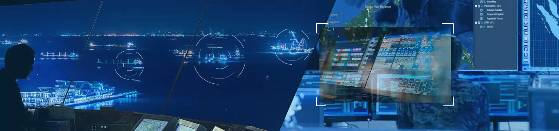
- Combat Command: During aerial combat, the three-coordinate radar continuously provides the command center with real-time battlefield situations. It can track a large number of friendly and enemy aircraft simultaneously, clearly presenting the three-dimensional dynamics of each target. Commanders can precisely dispatch fighter jets and allocate air defense firepower based on this information, making air combat operations more orderly and increasing the chances of victory.
- Weapon Guidance: Some precision-guided weapon systems are equipped with miniaturized three-coordinate radar technology. In the terminal guidance stage, they can independently detect the precise position of the target and guide the weapon to accurately hit, improving the strike accuracy whether it is against ground fixed targets or moving ships at sea.
Civil Field
- Air Traffic Control: In busy airports around the world, three-coordinate radar is the core equipment for ensuring the safe and orderly operation of air traffic. Take large international airports as an example, where hundreds of flights take off and land every hour. The radar constantly monitors the airspace around the airport and accurately grasps the position information of each aircraft. Based on this, controllers can reasonably arrange the takeoff and landing sequence of flights, plan flight routes and altitudes, eliminating the risk of mid-air collisions and ensuring smooth travel for passengers.
- Meteorological Monitoring: It helps meteorologists gain a deeper understanding of atmospheric conditions. It can detect the distribution of water vapor at different heights within clouds, as well as the movement direction and speed of clouds. When it detects the formation and movement of rainstorm cloud clusters, it provides accurate data to meteorological forecast departments in a timely manner, assisting in the early release of disaster weather warnings, allowing people to make preparations in advance and reducing losses caused by meteorological disasters.
- Maritime Rescue and Ship Navigation: Coastal rescue departments rely on three-coordinate radar to search for distressed ships on the vast sea, quickly determine the ship's position and distance, and immediately organize rescue forces to rush to the scene to save lives and property. At the same time, it provides normal sailing ships with traffic dynamic information in the surrounding sea areas, helping ships avoid dangerous areas and collisions, ensuring the safe and smooth operation of maritime transport lines.
In general, three-coordinate radar, with its unique performance, plays an irreplaceable role in safeguarding national security in the military field and ensuring the convenience of life in the civil field. Moreover, with the development of technology, its application range continues to expand. In the future, it will present the following development trends:
Firstly, continuous improvement in technical performance. The precision and resolution will be further enhanced. Scientists will constantly optimize signal processing algorithms, antenna designs, and hardware performance to more accurately identify and track tiny targets. The detection distance will also be extended. By increasing radar transmitting power, adopting more efficient transmitters and low-loss transmission lines, and enlarging antenna size or using distributed antenna arrays, it is expected to achieve stable detection of targets thousands of kilometers away.
Secondly, multifunctional integration. It will deeply integrate with other detection technologies such as photoelectric and infrared detection. In the detection of aerial targets, the radar is responsible for long-distance discovery, while photoelectric and infrared devices perform more accurate identification and tracking at short distances. It will also have communication functions and become a key node in the battlefield communication network, realizing the interconnection and sharing of battlefield information.
Finally, intelligent development. With the help of artificial intelligence and machine learning technologies, it will possess autonomous decision-making and adaptive adjustment capabilities. When facing complex and changeable battlefield environments and diverse targets, it can automatically analyze target characteristics and threat levels, and autonomously select the best working mode and parameter settings. It will also have fault diagnosis and self-repair functions to improve system reliability and availability.
In conclusion, three-coordinate radar has a bright future and will continue to contribute to various fields in the coming days.