Airport Surface Movement Radar
Product Introduction:
Airport surface movement radar can be used to help controllers know about the real-time position and movement of stationary and moving aircrafts and vehicles, issue the instructions to avoid traffic congestion and conflicts of aircraft/vehicle in the intersection, choose an appropriate route for aircrafts, and determine whether the runway is occupied; and to provide navigation information for vehicle, rescue vehicles in the case of an emergency.
LW-R5-CJ-1 has been trial running for 5 years at XinQiao airport of Hefei, and has obtained the first temporary license for Surface Movement radar of China civil aviation equipment in April 2017. And you are welcome to check our equipment at any time.
Technical Features:
1.Inverse cosecant square pattern antenna ensures effective detection in the airport surface area with the system tower at various heights ( 15m~110m ).
2.Full-solid state transmitter with easy installation and maintenance, low life-cycle costs.
3.Large dynamic receiver ensures all targets within the airport have a full range of effective monitoring.
4.Frequency diversity and frequency agility are adopted to reduce targets flicker and improve the detection probability and detection accuracy.
5.High data rate; the minimum speed of the antenna with 60 rev/min is required to realize information update in seconds.
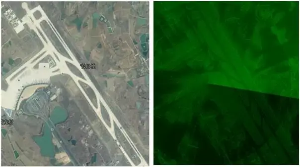
6.The capabilities of target identification, high resolution and high positioning accuracy are realized. Real aperture imaging technique is adopted for imaging processing on targets. A large bandwidth signal and large size antenna are used to realize high resolution of range and azimuth.
7.High security, high reliability and strong environmental adaptability are realized to support all-day operations. It therefore is an important means of airport operation surveillance in low visibility situations.

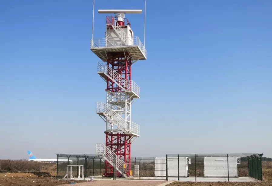
Figure 1 BWSMR Antenna Tower at Xinqiao Airport |

Figure 2 BWSMR Real Aperture Imaging and Image Com |

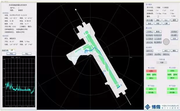
Figure 3 BWSMR Local Device Maintenance Display InterfaceNote: In the display in Figure 3, T4 is the guide vehicle, T3 is the landing aircraft, T2 is the aircraft waiting to take off, and T10 is the vehicle running on the ring road. |

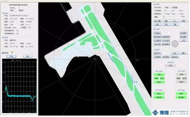
Fig. 4 Comparison of original echo (above) and point-to-track display (below) of BWSMR target detection and display effectNote: In Fig. 4, T106 and T112 are landing aircraft. The above picture shows the original echo display result, and the following picture shows the track display result.parison on Google Earth Map |
Main Performance Parameter
| System architecture: | double redundancy ( except for antenna and servo control system ) |
| Frequency range: | Ku-band |
| Detection range ( Pd=0.9, Pfa=10-6,σ=2m2, category SW-I targets ): | |
| Range: | 150m~5500m (sunny) 150m~3600m (16mm/h rain) |
| Height: | 200m |
| Azimuth: | 360° |
| Resolution: | |
| Range: | 7.5m |
| Azimuth: | 0.25° |
| Positioning accuracy: | 3m (The position of 1000 meters from the radar) |
| Antenna gain: | ≥37.3dB (Beam center) |
| Type of transmitter: | All-solid-state transmitter |
| Emission peak power: | ≥140W |
| Antenna rotation speed: | 60 rad/min |
| Target processing capability: | 5000 points/s |
| Data transmission mode: | Ethernet network |
| Output data format: | ASTERIX CAT240, ASTERIX CAT010 |
| Reliability: | MTBCF≥28000h, MTTR≤0.5h |
| Availability: | ≥0.9999 |
Interested in our company?
or
Contact us now. Learn how our radar uses actionable data to make your operations safer.

